
Start a Boardman Township Street Directory Search
A strong address trail starts with the address itself, then follows the county’s property identifiers instead of guessing from nearby numbers. The Mahoning County Auditor is the first source because its address results identify parcels and show property facts. A parcel is a unit of land in the county record. It can connect a situs, or physical property location, to a legal description and recorded sale material. That connection is useful for a Boardman Township street directory search, even though it does not name every person who may live there.
For a whole road, use the Auditor’s Address Search. Leave House Number and House Number High blank, enter Street Name, and omit words such as Street, Drive, or Lane. A single number can locate one address, and a low and high number can narrow a range. Open each returned parcel before drawing a conclusion. The Auditor reports 163,344 parcels countywide, so a broad result still needs parcel-by-parcel review.
- Enter the known Boardman Township address, or use the whole-street syntax in the Auditor Address Search.
- Open the matching result and capture the parcel number, situs address, legal description, sales facts, Deeded Owner Address, and Tax Payer Address.
- Use the parcel number to orient the property in the Mahoning GIS/Tax Map, then return to the Auditor record for the textual property trail.
- Use the legal description, current acquisition, document number, or party name in the Mahoning County Recorder index and compare the actual recorded instrument.
- For a named voter, the Ohio Voter Search can confirm registration and election geography. For an older address, check the 1914 county directory or a confirmed reverse-directory volume rather than treating either source as a current roster.
Note: The voter lookup is name-and-county based, not a control for browsing every person on a street.
Boardman Township Street Directory Search Fields
The Auditor offers a quick field marked “Search by Parcel, Owner or Address,” plus Owner, Parcel, Address, and Advanced Search modes. The official instructions permit partial owner entries and parcel numbers with zeros, dashes, or dots. The street-directory use is the address mode, but the expanded fields can narrow a property set by sales, location, land, or structure facts. All fields below are the captured labels and notes from the county’s public form. A result remains a property record, not an occupant list.
| Field Label | Type | Required | Options / format notes |
|---|---|---|---|
| Search by Parcel, Owner or Address | text quick search | not marked | One query box; official help says parcel, owner last name, or address. |
| Owner Name (Last First) | text | no marking | Official guide permits partial last name, last name only, last name + first initial, or last name + first name. |
| Parcel Number | text | no marking | All zeros; dashes/dots optional according to guide. |
| House # | text | no marking | Combine with street fields; leave blank for whole street. |
| Direction (Abbv) | text | no marking | Abbreviated directional component. |
| Street Name | text | no marking | Guide says omit Street/Drive/Lane wording. |
| Street Type (Abbv) | text | no marking | Abbreviated street type. |
| Sale Date From / To | date pair | no marking | Sales criterion. |
| Sale Price From / to | numeric pair | no marking | Sales criterion. |
| Buyer’s Name / Seller’s Name | text | no marking | Sales party fields. |
| Valid Sale | select | no marking | Options not exposed in static capture. |
| Tax Districts / Townships / Municipal / School Districts / Neighborhoods | selects | no marking | Location filters; current option lists require live interaction. |
| Land Property Class | select | no marking | Land filter; current option list requires live interaction. |
| Acreage From / to | numeric pair | no marking | Land filter. |
| Year Built, Living Area, Bedrooms, Full Baths, Half Baths: From / to | numeric pairs | no marking | Residential filters. |
The property page can show a sketch, aerial/GIS map, legal data, valuation history, sales, taxes, special assessments, and a printable Property Record Card. Record the field name and date seen. A deeded owner or a tax payer may have a mailing address elsewhere.
Boardman Township Street Directory Record Coverage
Address research works best when each source has one defined function. The Auditor establishes the parcel. GIS places that parcel along a road. The Recorder holds the recorded-document chain, while the township can supply an address-and-project trail when a retained file is releasable. Historical directories use different address language. The following coverage table keeps the Boardman Township street directory focused on what each record can actually support.
| Address-record source | Key / chain function | Access | Limit |
|---|---|---|---|
| Auditor Address Search | One address, range, or whole street to parcels | Public web/counter | Property/owner record, not occupant list. |
| GIS viewer | Street segment to parcel orientation | Public map/GIS staff | Approximate boundaries; not legal survey. |
| Recorder | Parcel/legal description to deed chain | Laredo + counter terminals | Online date discrepancy; verify with actual index/counter. |
| Boardman zoning/permit files | Address to project/record chronology | Portal/request/counter | Record retention/release varies; no person conclusion. |
| 1914 county directory | Township/RFD/crossroads to historical household lead | PLYMC Digital Archive | Rural addressing; not modern streets. |
| Reverse directories | Address to historical printed entry when scope includes locality | LC/collection verification | Boardman inclusion and individual years must be checked. |
Use the parcel number and legal description to keep the sources aligned. A recorded owner name, a mail-to address, and a historic directory entry answer different questions. Dates matter as much as names.
Read Boardman Township Street Parcels
A street number alone can change or sit beside a vacant lot, a cul-de-sac, or a newly split tract. Boardman Township’s road history includes more than 500 streets and 164 cul-de-sacs. That is why a Boardman Township street directory needs the parcel record as its anchor. The physical address, mailing fields, and legal description should be copied separately before a deed or historical source is compared.
- Parcel
- A county property unit with its own identifier, assessment facts, and link to a situs and legal description.
- Situs address
- The physical location of the parcel being assessed. It is distinct from either mailing-address field.
- Plat
- A lot, block, or subdivision reference used with the legal description to connect a property card, map, and recorded document.
- Criss-cross directory
- A reverse directory arranged from address to entry when a particular volume’s geography includes the locality.
The Auditor labels Deeded Owner Address as the address from the last recorded document. Tax Payer Address is where correspondence is mailed. Neither field establishes present residence. A Youngstown mailing label on a Boardman Township parcel can be a postal fact, not a jurisdiction change.
Boardman Township Street Map Boundaries
The GIS/Tax Map is the spatial step, not the final proof. Navigate to a street or parcel, note the parcel identifier, and open the Auditor record for the property details. The county says its parcel boundaries are approximate and informational. A legal survey and the original recorded documents control exact boundaries. Do not infer adjoining parcels from odd and even street numbers, especially where subdivision plats, vacant lots, or curved roads interrupt numbering.
GIS staff are at 21 W. Boardman Street in Youngstown, 330-740-2455, and the county says GIS training can be scheduled. That counter route is useful when the current viewer changes or a map question requires help. No buffer, radius, or selection tool is assumed here because the detailed live controls were not captured in the research.
Follow Boardman Township Street Deeds
After finding a parcel, use its sale information, legal description, and current acquisition to search the Recorder’s land records. Locate the acquisition by current owner as grantee, recording date, document number, or legal description. Read the instrument, then search the prior owner as an earlier grantee. At every step, compare the lot, block, subdivision, tract, or parcel description rather than relying on a shared surname or a similar road label.
The Recorder says free registered Laredo search and printing cover 1980 to present after a sign-up sheet is returned by mail, fax, or in person. It also provides thirteen public computers. The counter is at 120 Market Street, first floor, Youngstown, with regular hours of 8:00 a.m. to 4:30 p.m.; basement self-service hours are 8:00 a.m. to 4:00 p.m. Staff do not conduct open-ended searches, but a known recording can be requested as a copy.
Boardman Township Street Records: 1980 or 1985
The Recorder’s online coverage needs a date check before a long address trail begins. Its current Laredo statement says 1980 to present, while a different Recorder page says electronic indexes begin in January 1985 and directs users to the office for pre-1985 records. Both statements concern online availability, not whether older documents exist. The Recorder says its documents extend to the early 1800s.
For a document near the gap, check the live index and be ready to use one of the thirteen public computers. Bring the parcel’s legal description and a known document reference where possible. This preserves the source discrepancy instead of turning one online date into a claimed cutoff for all Boardman Township records.
Boardman Township Street Permit Trail
Boardman Township’s permit applications and fees page documents an address-level route for construction, alteration, zoning, complaint, and board-history questions. The Planning & Zoning Department is at 8299 Market Street, Boardman, OH 44512, 330-726-4181, weekdays from 8:00 a.m. to 4:00 p.m. Its official page directs users to search an existing complaint or permit, apply for a permit, and submit a complaint through the current portal. It does not establish a complete historical file online.
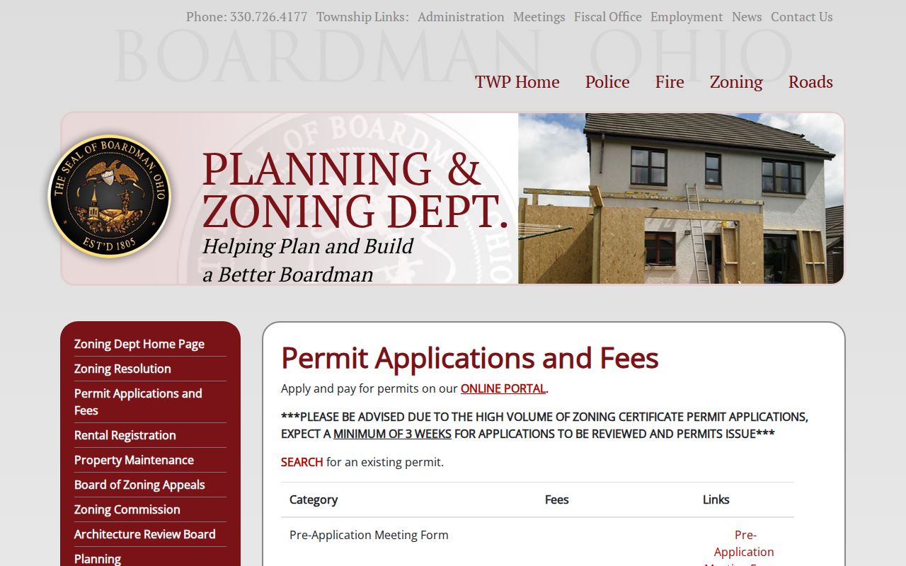
Permit material can date a physical change at an address. It should not be used alone to identify a current household or to assume the live portal uses any particular search field.
Published examples include fences at $25; small sheds, carports, pavilions, and gazebos at $0.25 per square foot; detached garages at $0.36 per square foot; decks at $0.15 per square foot; above-ground pools or hot tubs at $25; and in-ground pools at $50. Published copy prices are $0.05 for 8.5-by-11 black-and-white, $0.25 for 8.5-by-11 color, $0.25 for 11-by-17 black-and-white, and $0.50 for 11-by-17 color. The page warns that high certificate volume brings a minimum three-week review and issuance expectation.
Township zoning materials identify revision PZ-24-07 as adopted August 12, 2024, and a current zoning map as updated through A-25-01 on November 20, 2025. Those are dated zoning-reference points, not evidence of ownership or a permit history for a particular address.
The township’s public-record request form accepts a property address, record description, and paper-copy or emailed-PDF choice. It says some materials can take up to 30 days because they are in offsite storage. The form offers mail and email submission channels, and payment may be cash, check payable to Boardman Township, or Visa, MasterCard, or Discover. Card or debit processing is 2.95 percent or $2.50 minimum. Under Ohio Revised Code 149.43, a written request can help identify a record but is not required, and the optional reason field does not control access.
Note: A narrow request should identify the address, time span, record category, and preferred medium.
1914 Boardman Township Street Clues
The 1914 Official Mahoning County Directory uses the address language of its time. It was compiled by O. A. Potts and published by the Mahoning County Directory Company to supplement Youngstown coverage with county residents and corporations outside the city. The key explains spouse brackets, compass or landmark location, township, rural free delivery, children, telephone, and acreage. One Boardman Center entry reads “Boardman tp. rfd Poland 2,” while another uses “½ n Cooks Cors” and Youngstown RFD 4.
Search an older Boardman Township street by surname, township, rural route, crossroads, telephone, acreage, and land description. A present street number or ZIP can miss the relevant entry. The Library of Congress lists Youngstown/Warren reverse directories for 1965 through 1995, with 1974, 1975, and 1983 missing, but its guide does not confirm Boardman coverage in every volume. Verify a chosen volume’s geography with the Library of Congress, PLYMC, or the Mahoning Valley Historical Society.
Boardman Township Street Directory Limits
A parcel card can identify assessed property facts and recorded ownership-related information. It cannot enumerate every household member. A permit file may show a project or named party, but the person’s role and the record’s release status must be checked. Utility and delivery information are not public resident rolls. Ohio motor-vehicle personal data is closed under the Driver’s Privacy Protection Act and Ohio Revised Code 4501.27.
The Ohio voter lookup is an individual registration and precinct check that requires a first name, last name, and county. It does not provide a public “browse everyone on this street” function. Daily Mahoning County voter snapshots are date-specific and omit confidential participants and other protected information. A non-result is not proof that someone does not live in Boardman Township.
Lawful use. Boardman Township street and address records support personal, lawful research and record verification. Do not use a name, address, or record trail to stalk, harass, intimidate, or harm anyone.